In an effort to overtake Google Maps and clinch the title of “King of Maps”, Microsoft’s Bing Maps has rolled out an visually impressive and mind blowing feature that could leave Google Maps behind. The new application, known as Streetside Photos, mines geo-tagged photos from Flickr, associates them with Bing Maps Streetside photos and then overlays them by stretching the photo to form fit where in the world it belongs.
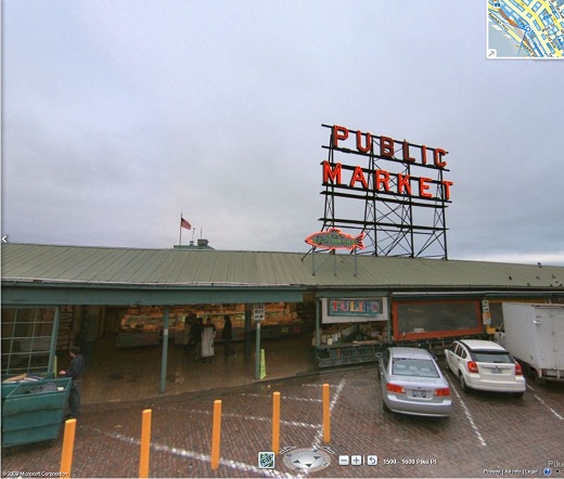
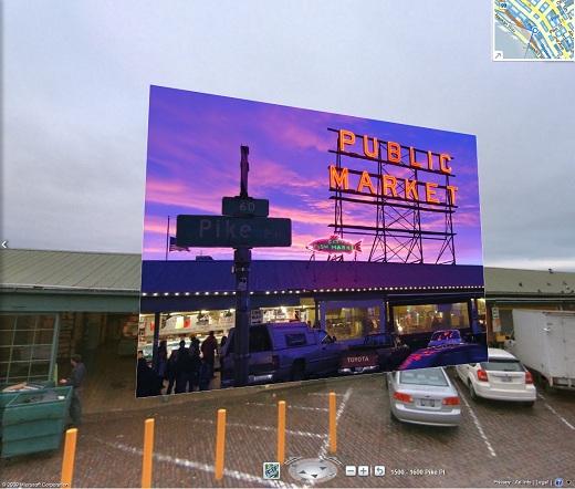
For example, when you look at a Public Market (as seen below) on Bing Maps, you’re able to view the default imagery together with geo-tagged photos from Flickr. This is particularly useful when you would like to take a peek of how it looks like at night or sunset. Another possible usage of Streetside Photos is to check the crowds at a particular time of the day. If the original photo on Bing Maps shows many people shopping for goods during the day, but Flickr images taken at the same location during the night state otherwise, then of course you should do your shopping during the day if you prefer fewer crowds.
This awesome innovation is now live in a preview version, and currently available in Seattle, San Francisco and Vancouver (Canada). It was demonstrated by Bing Maps architect Blaise Aguera y Arcas at the TED conference yesterday.
Original:
Integration with Flickr photos:
Video: